|
三個年代
安朔葉教授來台的第二年(1982),花了約一星期的時間在台灣西部丘陵區(麓山帶)從事野外地質工作,從北到南範圍涵蓋了台北、苗栗、台中、南投、嘉義、阿里山、台南、恆春等地。隨後又在1986、1989年及90年代多次造訪西部麓山帶進行野外地質探查。其中82及86年的工作就有了突破性的新發現,推論菲律賓海板塊和歐亞大陸的擠壓碰撞有兩期,板塊聚合的方向也有明顯的改變。這個結果也於1986年發表在台法地球科學合作論文專刊中,隨後廣為地球科學界引用。 In 1982, the year following his first arrival in Taiwan, Professor Angelier spent about a week doing fieldwork in the Western Foothills of the island, from north to south including Taipei, Miaoli, Taichung, Nantou, Chiayi, Alishan, Tainan and Hengchun. This was followed by multiple visits in 1986, 1989, and the 90s, leading to breakthrough discoveries explained in an insightful theory published in journals in 1982 and 1986. He proposed two stages in the collision of the Philippine plate with Eurasia, with a change of direction of plate motion. Main results also appeared in the special issue of France-Taiwan earth science collaboration in 1986 and have been overwhelmingly cited since then. 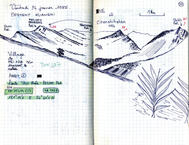
新竹叉尖山(1986作)岩石有時可以展現壯麗的自然景觀,例如美國大峽谷、加拿大洛磯山脈。台灣其實也有不少壯麗的自然岩石景觀。在安朔葉教授一個地質學家的眼裡,新竹叉尖山就是個例子。叉尖山的砂岩呈現一個大型的圓弧,雖然只是一張單色素描,岩石的特性及俊美的山勢,在他的筆觸下很具體感性的表露出來。 View to Chajiashan, Hsinchu (1986)Rock masses could sometimes display the splendor of natural beauty, such as America's Grand Canyon and Canada's Rocky Mountains. Similarly, Taiwan possesses no less of such spectacular landscapes. In the eyes of a geologist, such as Angelier, Chajianshan of Hsinchu is a classic, splendid example. Although simply a monochromatic sketch, the giant arc shaped by the sandstone masses stood out in all its grandeur. 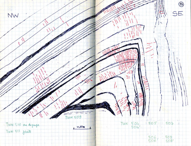 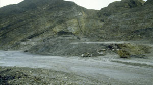
彎曲變形的岩層,翡翠水庫(1986作)翡翠水庫是1980年代因應大台北用水需要而興建的水庫及水壩。工程興建期間,也因地質調查發現了一些地質岩石露頭。這是水壩附近的一個大型岩石彎曲變形(背斜褶皺)露頭(數十公尺寬及高)。在安朔葉教授的筆下,呈現了地質學家看岩石風景的另一個角度,素描中清楚凸顯了地層突兀彎曲、砂頁岩交疊的特色,紅色的線段更是強調了厚層砂岩中發展了一組節理。 Anticlinal fold, Fetsui Resevoir (1986)Fetsui Reservoir was built in the 80s to provide water resources for the metropolitan Taipei area. During the construction period, several rock outcrops were discovered alongside the geological survey. This sketch shows an outcropped large-size anticlinal folded rock (with lengths and widths amounting to several meters) near the dam site. Under Angelier's pen, the geologist's perception of rock landscape starts to come to light. The sketch vividly illustrates the bended and folded rock strata of intercalated sandstone and shale, in which the red line underscores the joint sets in the thick-bedded sandstone. 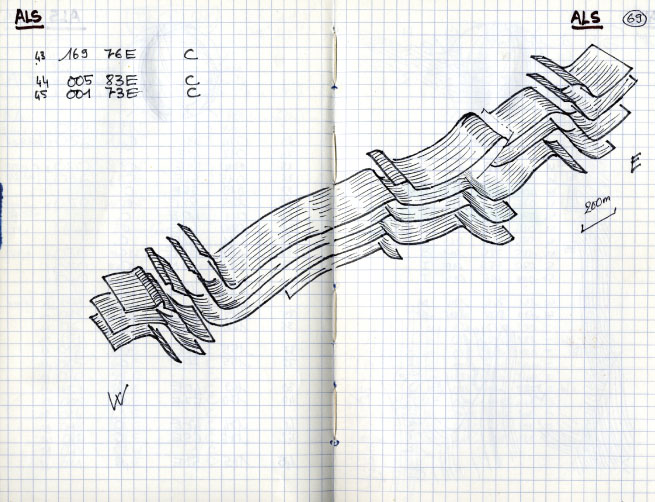
地層重疊彎曲空間示意,阿里山公路(1982作)位於西部麓山帶丘陵區的阿里山公路,在80年代還不是一條寬敞平順的公路,路況也比較差,但是路旁的露頭對安朔葉教授來說卻是異常精彩豐富。麓山帶岩石受板塊擠壓及造山所產生的變形構造,像一幕幕的幻燈片一樣接續出現在眼前。在一個長約一公里幾乎連續的露頭,地層表現了重疊連續性的褶皺彎曲,他把野外現場露頭紀錄即時拼接,並且將岩石用非常工藝化的立體感呈現出來,應該算是此圖的亮點。 Folded strata, Alishan highway (1982)In the 80s, the Alishan Highway cutting across the hilly western Foothills was not yet a smooth road as the sidewall on the highway remained to be paved. The exposed rock strata provided an excellent opportunity for Angelier to illustrate the richness of geological structures. The panorama of folding and deformation by plate tectonic and orogenic forces came afore as if in a succession of film slides, in an approximately one kilometer-long continuous exposure of outcrops. Angelier achieved this feat by piecing together the in-situ sketches of the series of superposed and stacked bended and folded rock layers in an artistic display of insightful 3-D geologic expressions. 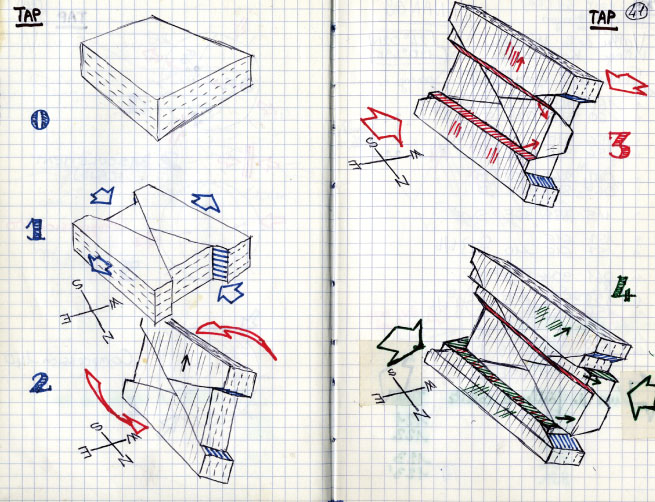
岩石斷裂演化方塊圖練習(1982作)這是經過幾天在苗栗、台中地區麓山帶的野外地質調查後,安朔葉教授在野外所做的綜合歸納。這些原本在淺海水平沈積,經由觀察分析,並隨手以方塊圖繪出,是安教授的註冊商標。很難想像如此複雜的空間工藝圖,怎麼在他的筆下如此輕鬆畫出?又能精確表達出地層受應力擠壓斷裂的過程? Evolution of faulted strata (Essay) (1982)These sketches show Professor Angelier's synoptic view of the western Foothills in the Maioli and the Taichung areas, after a few days of field investigation in 1982. Such synoptic block diagrams, drawn freehandedly yet accurately and precisely illustrating the complicated deformation processes of faulting and folding through time, represent the hallmark of Professor Angelier. It is difficult to imagine how he could have extemporaneously and easily achieved the terrific feat of visually presenting geological meaning with spatial esthetic beauty. |


