|
三個年代
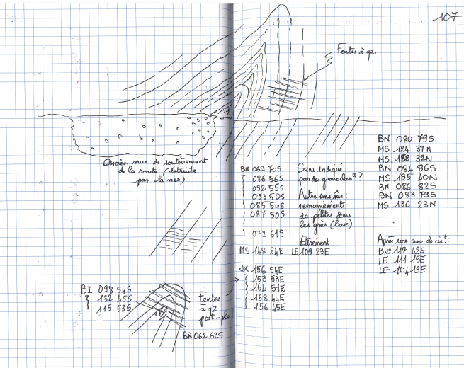
中央山脈是安教授在三十年的台灣地質旅程中,一直努力不懈嘗試了解的區域。這三張圖表現了中央山脈地質展現的不同面貌。 左圖是地質學家在野外露頭工作時所看到的中央山脈,它表現出變質岩複雜的變形構造。中間圖是中央山脈反映的地形特徵之一,這是在花東縱谷西側的中央山脈,顯露出好幾個階段不同高度的三角錐面侵蝕,表示山脈持續在抬升。右圖是地質學家從台灣整體造山帶來看中央山脈的演化及地質構造特色。安教授的這幾張手稿記錄及繪圖,表現了他從地質學家的角度,看到的中央山脈。 The mountainous Central Range occupies an important portion (about two third of the area) of the Taiwan Island. It is also geologically more complex area than other places of the island. Angelier spent many times of field surveys in the Central Range for better understanding its geological characteristics. Here the three figures display different aspects on viewing the Central Range from Angelier. 
三角錐面,中央山脈東側地形示意圖(2003)Triangle Facets, eastern edge Central Range (2003)Triangle facets are commonly observable geomorphic features along the eastern edge of the Central Range against the Longitudinal Valley in eastern Taiwan. Bearing on their potential geological implications, Angelier made sketches on these triangle facets near Fuli area. He also hypothesized that there are at least three levels of erosion surface probably associated with uplift or normal faulting in the eastern margin of the Central Range. |


